The Cornmill
THE 1854 AUCTION
The Luddenden Cornmills were owned by The Murgatroyd family for the majority of their life, the first record of a mill here was from 1274. There is a lot of published information about the early years of the Luddenden Mills (such as https://familymurgatroyd.com/mill.htm)
The last Murgatroyds to run the mills were brothers Hartley (1797-1865) and John (1799-1873).
The brother's seem to have got into some financial difficulties and had to sell a lot of property in Luddenden and the surrounding valley including the Cornmills.
Twenty lots were put up for auction at the Murgatroyd Arms on 19th July 1854. Neither of the Mills sold on the day, but both change hands shortly afterwards.
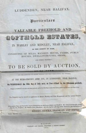
The brochure for the auction included two maps, the first showed the lots for sale on the hills surrounding the village.
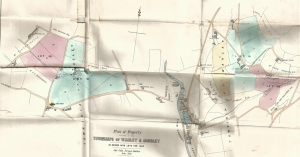
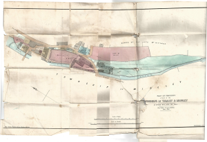
The second map shows the village lots.
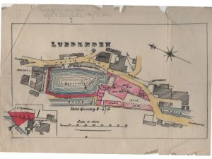
On this second map, Lot 13 is Upper mill and includes the mill pond and a plot of land and sluices next to the weir. The land that the mill occupied is now housing (High Street Court).
The map shows the function of each of the buildings in the mill. The majority of the mill was being used for malting barley ready for making beer.
An accompanying document also describes the property;
All that valuable Corn Mill called "Upper Mill" situate in Luddenden, with the Malt Kiln, Warehouses, Stabling for 18 Horses, Wagon and Cart sheds, Gighouse, Joiner's Shop, Paved Yards and Outbuildings. Also the Reservoir behind the same, containing 2,008 superficial square yards, with the Water Wheel and the entire Fall of the Luddenden Brook, being about 30 horsepower. And also the Weir and Dam-stones across the Brook, Cloughs, and the Plot of Ground appropriate thereto, together with the use of the head Goit and the Tail Goits. The Mill is five stories High, and attic, and the whole of the premises have been recently rearranged. The water wheel is a new iron one, 27 feet in diameter and nine on the breast.
The wheel generated about 30 horsepower.
Lot 14 is Lower mill. The three stoery building now know as The Cornmill is the only surviving part of the mill shown on this map. The two storey part of today's Cornmill was a later addition (but built before 1890).
On the map, you can see the head and tail goits that fed the water wheel. You can see that there is a boiler room and a chimney (so this mill had steam power at this date). There are cottages to the south side of the mill and a building labelled as Counting House adjacent to the bridge.
The land of Lot 14 is labelled as 'Holme' and it extends as far as the next weir on the brook. This whole area is now occupied by Blue Bell Walk. The field above Lower Mill, Lot 15 is labelled as 'Bank'. The Eastwood family bought both Lot 14 and 15 in about 1856 and immediately started to convert and extend this mill into a sizable woollen mill.
Below is a copy of the previous map, highlighting Lot 13. This hand traced copy is part of a document drawn up in 1856 when Upper Mill was sold by Hartley and John Murgatroyd to the Thompsons and their partner, Joseph Starkey (who bought a third share in the mill).
